- Nature
- Trips
Caving Trips at Summer Camp
The following was written by Larry Davis, who is in his 41st year as Director of Nature Programs and Teaching. If you like, download a PDF version of this article, complete with more pictures and a map.
“Our caving trip began on Friday and, after a short drive and a quick stop at Larry’s sister’s house, we arrived at the first cave. In the first cave we saw a 75-foot ‘showerdome’ and we enjoyed that a great deal! We stayed with Larry’s sister that night and she gave us a great breakfast the next morning. The second day began with a short walk that took us to a ladder, which brought us to a deeper spot to explore the Gun-barrel, the Dungeon and many other cool places. Larry told us great stories in the caves and as he told the stories, we went into a place where we were neck deep in water, which was really cold! Overall, the trip was great and we can’t wait for the next trip, the ‘advanced caving’ trip.”
-Patrick Mimms (Senior 3)
 Pemi boys have been caving since 1982. It is a challenging and exciting activity, akin to mountain climbing, only underground. If you like wet, muddy, dark places, you’ll love caving. It has an undeserved reputation of being dangerous. Of course, as with other outdoor pursuits such as mountain climbing, canoeing, or kayaking, the failure to use proper equipment or to observe appropriate safety procedures can get you into trouble. Cavers call ill-equipped, unsafe cave explorers “spelunkers,” and in the caving community a common phrase is “Cavers rescue spelunkers.” When I’m wearing my other hat, that of a college professor/geologist, my research specialty is cave science. My sister, Emily (with whom we stay and who helps lead some of our trips) is an internationally-known caver. Given this experience, you can be sure that our cave trip participants are properly equipped with helmets, knee pads, gloves, warm clothing, and three sources of light (a helmet-mounted LED lamp as primary, a flashlight as secondary backup, and a candle with matches for emergencies) and that we always cave safely.
Each summer we take two caving trips, a beginning trip that visits easier caves (the equivalent of some of our lower mountain peaks) and an advanced trip that includes more challenging caves. I will describe both in some detail here, and I will include some pictures both of the caves and of our recent trips.
On each trip, we take up to nine campers, along with three staff members. The minimum age for campers is 13, although we almost always fill the trip with 14- and 15-year-olds. Boys must also have demonstrated an ability to follow directions and exhibited a high level of maturity before we accept them as participants.
Our caving program has two major goals. The first is to teach the boys about caves and cavernous regions (which go under the name of “karst.”) While in the caves we talk about cave formation and development, biologic environments, and conservation. On the surface we talk about such features as sinkholes and springs and also consider the environmental problems associated with karst. The second goal is to challenge the boys both physically and mentally and to give them an opportunity to explore a part of the world that few get to see. We do all of our caving in New York State in an area around the town of Schoharie, which is about 30 miles southwest of Albany. While it is about 200 miles away from Pemi, it is the closest karst region to camp. There are over 200 mapped caves here, with more being discovered all the time. There are also two commercial caves, Howe Caverns and Secret Caverns. While we don’t visit these, you may want to – just to see what caves are all about.
Beginning Caving: On the beginning trip we visit three caves. They are very different from each other in terms of size, morphology (shape), formation, geology, and exploration challenge. Cave passages have one of four basic shapes, canyon-like, vertical shaft, rectangular, or elliptical, with combinations such as keyhole (elliptical on top and canyon-like on the bottom) possible. The first cave on the trip, Schoharie Caverns, is canyon-like. This type of passage is formed by flowing water, a cave stream. From the very beginning we follow one, upstream, along its course through the cave, much of the time just splashing in the water, but in a few places submerging ourselves in waist-deep pools. In most places the cave is only two or three feet wide, but ceiling heights range from 10 to 40 feet. The passage itself is generally straight, following natural fractures in the rock (called “joints”). Where joint sets intersect, however, the passage makes right angle bends. At one point a seventy-five foot high vertical shaft “pierces” the canyon (this is the “showerdome” mentioned in Patrick’s comments at the start of this newsletter). These shafts (known as “dome-pits”) form independently of the main cave by a process of top-down solution that begins at the surface, which at this point is more than 300 feet above us. For, while the cave passage has been pretty much horizontal, the land above us has risen sharply as we proceeded into the Earth.
This is the only cave on the beginning trip that has extensive formations (dripstone). Stalactites hang from the ceiling (they hold “tight”). Flowstone covers the walls, looking like frozen waterfalls. Slight differences in the temperature of the cave and its water, along with the amount of carbon dioxide in the cave atmosphere, determine whether solution of the rock or deposition of dripstone takes place. The system is exquisitely sensitive to tiny variations in either of these variables.
Our trip ends in a large room where the cave stream emerges from a low opening in the wall. Beyond this, the passage is entirely water-filled, accessible only to cave divers (a very dangerous sport indeed.) We turn out our lights to experience the complete and absolute darkness that, beyond the womb, can only be found in a cave. To exit, we retrace our route, but I let one of the campers lead. Even though we traverse exactly the same passage, it looks completely different from the other direction. This is a good lesson in caving technique. On the way in, you should periodically turn around and look behind you so that you will have some idea what things will look like when you reverse direction.
The second cave we visit is Knox Cave (a map is included in the PDF version). It features large rectangular-shaped rooms with arched ceilings. This type of passage most often occurs when the cave is not far below the surface. The primary mode of formation is solution along joints and then enlargement of the passage through breakdown (large blocks falling from the walls and ceiling.) We see these large blocks everywhere. There is no danger now, however, as cave forming processes are extremely slow and there is even strong evidence that the blocks fell thousands or tens of thousands of years ago. Knox Cave has many parallel and side passages, and this gives us a chance to allow the boys to do some exploring on their own. We use the buddy system and I, along with my staff assistants, James Finley and Richard Komson, station ourselves at strategic locations to keep an eye on things.

After exploring the front part of the cave, we descend through a low, wide crawlway into, first, an elliptical passage, formed when the cave was completely full of water, and then a keyhole-shaped passage, the slot in the keyhole formed by a cave stream that flowed after the passage started to drain. Finally we enter a long, wide room that terminates (almost) at the internationally-famous “gun-barrel.” This aptly named, fifty-foot-long, nearly circular tube is only one and a half feet in diameter. It leads to the back part of the cave, which is half-again as long as the front part that we have just visited. On this trip, we do not go through the gun-barrel (I never do; I’m just too big and my claustrophobia wouldn’t let me do it anyway.) Some will go through on the advanced trip, however. This is a good place for the campers to see what they might encounter on the later trip. It is also a terrific chance for us to talk about pushing yourself to find your limits but not being afraid to admit that you have them (I’m a perfect example of this.) There is no shame in turning back here (and besides, there is a by-pass that was dug out about 10 years ago.)
The final cave we visit on the beginning trip is Clarksville Cave (also known as Ward-Gregory.) The main entrance is a small opening on the floor of a sinkhole. From the large entrance room at the bottom, you can go right, into the Ward section of the cave, or left, through a small connector, into the Gregory Section. We start our trip in the Ward section. The passage is elliptical, indicating that it formed when the cave was filled entirely with water. The ceiling height varies between three and ten feet. An upper dry (but low and muddy) passage parallels the lower, and larger, wet section. In many places, the wall rock shows a pattern of solutional scallop marks. These are made by running water over a period of thousands of years. Smaller scallops mean faster moving water. It is actually possible to estimate the ancient water velocity by using their size. Near the end of the Ward section, we have a choice of going low through my favorite part of the cave, called the “Grottoes,” or going high through a muddy passage that avoids them. The Grottoes are a catacomb of rock filled with water.

The ceiling, however, gets lower and the water gets higher until, just before you exit this section, you are waist deep and bent over. Everyone in the group chooses to go this way. The reflection of our lights on the water and onto the walls produces a continually-moving pattern of light and dark. As we move, the water surface surges up and down. The waves hit the walls and the ceiling, and the sound echoes through the cavern.
We retrace our steps and enter the Gregory Section. This part of the cave has formed along an old fault. We can see evidence of past movement on the slanting surfaces that are the fault plane. After passing through a series of belly crawls and low rooms, we arrive at the “Bathtub.” Here we have to wade through a waist-deep pool.
Beyond the Bathtub, the character of the cave changes. This section features rimstone dams. When water pools in rock depressions, minerals can precipitate around the edge. Over time, the precipitates grow higher and higher which, in turn, means that the pool becomes deeper and deeper. We cross dozens of these pools and dams. Finally we come to a passage that is a five-foot-wide square chute angling down the fault plane at about 15 degrees. We slide down this into a deep pool of freezing cold water. We work our way along the edge of this pool to a place where the ceiling comes down to about 8 inches above the water level. We are submerged up to our necks – but, fortunately, this water is never prone to a rapid rise in level! After a quick duck under this spot, we emerge onto a slope where we can look back on the pool, known as Brinley’s Sump.

A short stoop-way takes us to huge, rectangular “trunk” passage, unlike anything we have seen so far. Drenched and muddy, we follow this out to the surface and exit the cave in a different place from where we entered.
Near the cave entrance, there is a place to change our clothes. Dry clothes feel so much better. After about a two-hour drive across the Green Mountains, we arrive at our dinner stop, the Chelsea Royal Diner in West Brattleboro, Vermont (highly recommended). The staff there knows us well and takes very good care of us. Filled up with delicious food, we head for home.
Advanced Caving: On the advanced caving trip, we revisit Knox Cave and go to one new cave: Gage’s. Here is camper Matt Sherman’s description:
“This past year, I went on if not the best, then one of the best camp trips ever: caving. It is a whole different world when you enter the caves of upstate New York. We all made our way through a very tight squeeze called the gun-barrel. It was 50 feet long and I think we were all glad that we did it afterwards. In the other cave [Gage’s], exploration was the name of the game. We came across different passageways that led to rooms, which led to more passageways. In one of the rooms, you could literally sled down mud [on your butt]. In another, you could make clay/mud sculptures. It was great. To top it all off, the food and accommodations were fantastic. It was an awesome trip.”
-Matt Sherman (Senior 1)

Time and space preclude a detailed description of these caves. However, some of the highlights include going through the gun-barrel passage in Knox (or opting for the by-pass.) Once on the other side, we turn the campers loose and they can look for the Mud Room (which once contained life-size “sculptures” of Mr. and Ms. Knox created by members of the Harvard Medical School Outing Club) or head for the “Lemon Squeeze” and the Alabaster Room. This year we allotted extra time for this cave and almost all of the campers made it to this highly decorated spot.
Gage’s (formerly known as “Ball’s Cave”) has a 48-foot entrance ladder that requires a belay. This gives us a chance to demonstrate some rope work and to discuss the differences between rock climbing and vertical caving (they are legion). The cave itself is a series of spacious rooms connected by narrow passages and loops. There are many faults, and I am most pleased when the boys recognize them, (“Larry, is that a fault there?”) Once again, we let the buddy pairs explore on their own. Eventually, all arrive at an extremely challenging “crawl,” whose name is unfortunately too indelicate for this journal. Those who complete it emerge soaked and muddy but with big smiles on their faces.
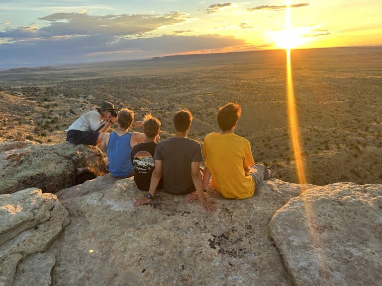
Surface Features: Finally, on the advanced caving trip, we take time to look at the geology of the area, including collecting some fossils, and at the surface features associated with Karst. We visit the property, owned by the National Speleological Society, surrounding McFail’s Cave, at six and one-half miles long, the longest in the Northeast. There are sinkholes, blind valleys, disappearing streams, swallow holes, and springs. Ask your campers to explain these to you. We also visit John Boyd Thacher State Park, about 10 miles southwest of Albany (highly recommended if you’re in the area.) Here we stand on top of the Helderberg Escarpment looking down a shear cliff face. The view is incredible. The Hudson Valley is 1000 feet straight down below us. The Taconic and Green Mountains are to the east (with Mt. Mansfield clearly visible.) And, to the north, we can just see the Adirondaks peeking out from behind the cliff face. The Native Americans who lived here carved a narrow trail in the cliff face. They farmed the valley below, but almost every night climbed the cliff to their village in the higher, more defensible position above. The trail is open to us now, and many of the processes that form caves are active there today and can be seen as we walk along. This short (45-minute) hike allows us to sum up the entire trip and to reinforce the lessons that we have learned.


